

Park map
Find your spot
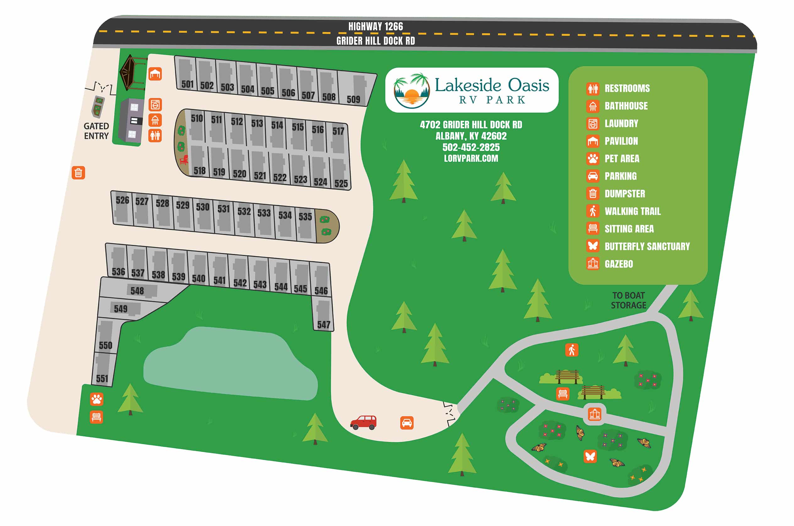
Fifty-one full-service sites, a gated entry and the planned amenities, all laid out on one map.
Interactive map
Find your place at the park
Tap any of the 51 sites to see where it sits, zoom in, switch to the aerial, or download the map for the trip.


Tap a site · scroll or pinch to zoom · drag to pan
Open siteSelected sitePlanned facilityReserved
of 51 sites openLayout guide, not to scale. Selecting a site does not reserve it or show availability.Prefer paper? Download the map as a PDF or as an image.
What you will see
Reading the map
- Concrete RV pads with 30/50 amp hookups, water and sewer at every site
- Wide driveways and access roads for large motorhomes with a tow
- Fenced pet area and the scenic walking trail
- Gated entrance and security camera locations
- Future locations of the bathhouse, laundry and picnic pavilion
- Adjacent access to Lakeside Boat Storage
- Less than one mile from Safe Harbor Grider Hill Marina
Choosing a site
Pick with confidence
Whether you are staying one night or a full season, the layout is easy to navigate and every site is a full-service site, so there is no wrong choice. Some guests prefer the sites nearest the trail, others like to be close to the entrance.
Want a specific spot? Mention the site number when you book and we will do our best to hold it for you.
Not sure? Tell us about your rig and how long you are staying, and we will suggest the best fit.
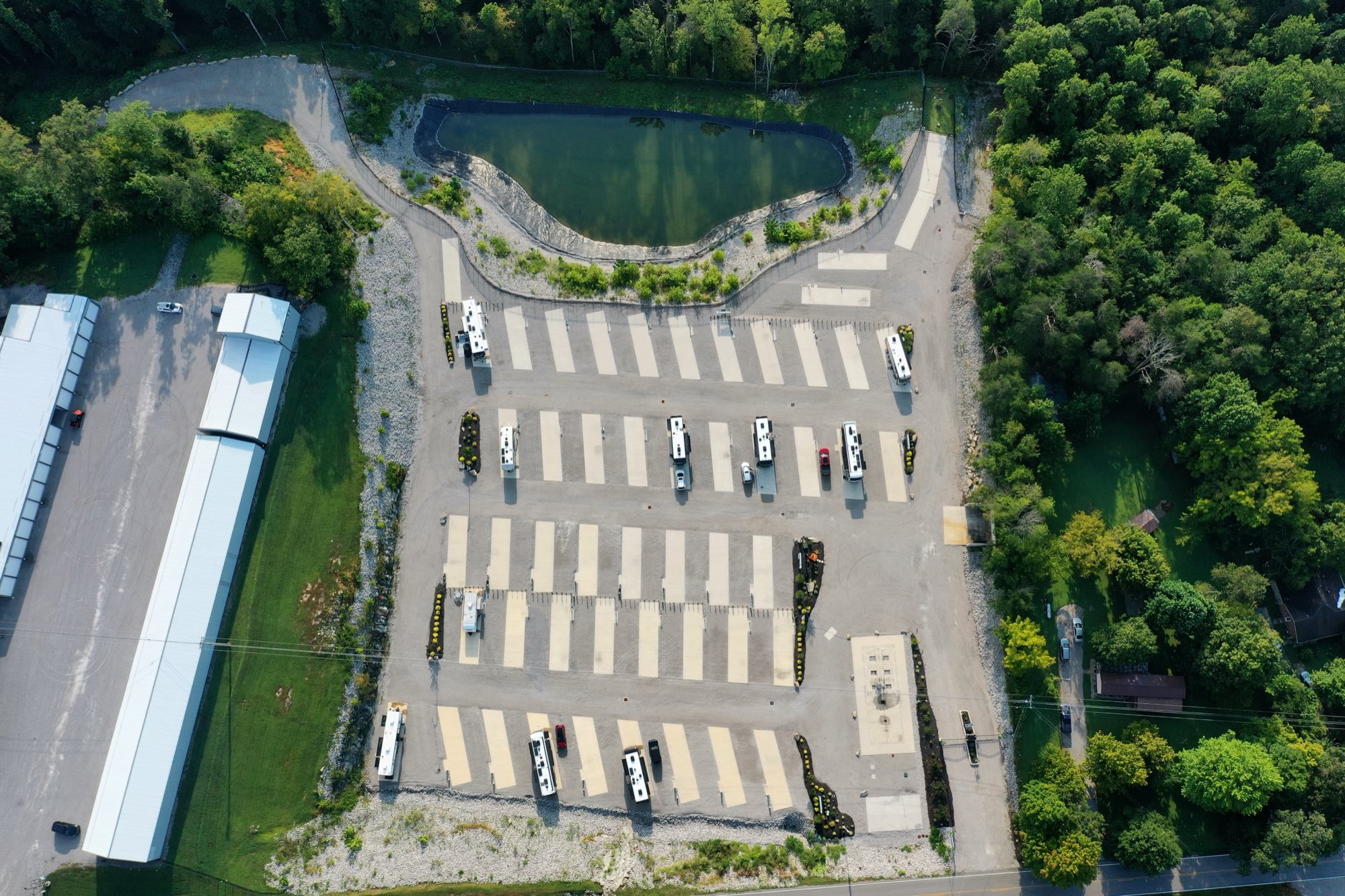
From the air
The map, in real life


Lake Cumberland, Kentucky
Ready to pick your site?
Call or send a note and we will hold it for you.